 |
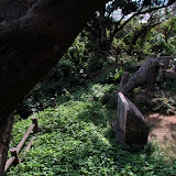
| Steps leading to the Bumagongen Shrine |
View Map It! Okinawa in a larger map
 |
| Bumagongen Shrine - Nago City |
GPS
| Latitude | Longitude |
| N 26 36.431 | E 127 54.051 |
The Bumagongen Shrine – Nago City
It is quite possible to live on Okinawa for many, many years, drive along Highway 449 a hundred times, and still never notice this very well hidden elaborate and mysterious shrine. This sacred grove sits on a isolated hilltop near the Motobu and Nago border well camouflaged by an unusual surroundings of rock quarries and giant machines that mask what should be a very visible and conspicuous shrine seen from the highway. This is the mysterious Bumagongen Shrine – Its origin may be as puzzling as its place and location.
Information provided by the Nago City Museum did reveal that the shrine may have been built some time during the Meiji and Taisho Period (1868-1926). It was during this time that various industries had faltered and the shrine was believed to help provide prosperity and to bring life back to the community. Originally, the sacred ground was only one tsubo in size (equivalent to two tatami mats). Reconstruction from September 5th, 1925 to its completion over a year later on December 7th, 1926 expanded the shrine's area. Ironically, though the shrine was meant to bring prosperity, the community that once thrived in that area is no longer in existence, and any legends and stories about the origins of its enshrined 'kami' or god may have been lost with it.
The architectural style was considered unique for its time. Two masonry craftsmen from Ogimi Village was said to have assisted in its renovation. However, the list of donors that aided in its reconstruction can no longer be found. In 1985, the Bumagogen Shrine celebrated its 60th Anniversary of its reconstruction, and from all accounts, still stood as it did many decades ago.
The cave. The cave is presumably where a 'kami' or god is enshrined. It sits in the rear of the stone structure. It is fenced off and not permissible for entrance.
Directions. If you take Highway 449 along the coastline going north look for a large mill-like structure to your right (Landmark icon designated above). Take the first right after you pass this Landmark. From there you should be able to navigate your way to the shrine entrance. It is roughly 600 meters from Highway 449. The torii gate will also be visible from Highway 449 if you look behind and to the right of the mill.
Notes.
1. Meiji Period (1868-1912), Taisho Period (1912-1926)


