Search Map It! Okinawa

Friday, September 30, 2011

"A School of Killifish Pond (Kanna, Ginoza)"

A viewing station at the 'School of Killifish Pond' in Kanna


View Map It! Okinawa in a larger map
A School of Killifish Pond (Kanna, Ginoza)
     GPS
     LatitudeLongitude
     N 26 29.420E 127 57.291


A 'School of Killifish' Pond in Kanna, Ginoza

This is a very quiet and serene pond in Kanna, Ginoza. It is adjacent to the Kanna Dam Family Park. There are about five stations on the pond where you can view different areas of the pond. Each station is connected by a wooden walkway (See photo album above). It is a nice place if you just wish to enjoy the tranquility and feel the nice breeze as you rest underneath one of the shaded stations. It is not a bad place to read a book or write a diary as you take in the surrounding nature (Note: there are no seats underneath the shaded stations, but the pillars make for a nice backrest).

The name 'School of Killifish' is actually a name of a famous Japanese nursery rhyme. In Roman characters the name is pronounced in Japanese as 'Medaka no Gakkou'. Killifish are a group of small fish that live in fresh water. They are found all over the world except Australia and Antarctica. Sometimes you hear them referred to as 'guppies'. The nursery rhyme talks about the Killifish playing happily together like little children, but you can't tell which is the teacher and which are the students. If you wish to see a transcript and translation of the lyrics, please go to Mama Lisa's World. You can also listen to a sample on YouTube.

What to bring. A camera, water, book and a bento lunch box (optional).
Other places of interest nearby. Kanna Dam Family Park, Kanna Dam, Ginoza Belly Button, Kanna Dam Watch Tower.

Source. Killi.net, Mama Lisa's World

Tuesday, September 27, 2011

"Bise Village Shell Shop"

The Bise Village Shell Shop


View Map It! Okinawa in a larger map
Bise Village Shell Shop

     GPS
     LatitudeLongitude
     N 26 42.413E 127 52.870


Bise Village Shell Shop

Welcome to the "Shell Shop" in Bise Village. If you are looking for ornaments, little gifts, or trinkets ...and happen to be in the area, stop by this little store. The shop is own by a very, very sweet Okinawan lady by the name of 'Hiroko'. She is so sweet, you will want to adopt her as your own. The unique thing about this store compared to others, is that Mrs. Hiroko makes a lot of her own ornaments and jewelry (mostly out of sea shells) - making them all the more unique. There is one particular jewel that she makes that literally comes from the heart and soul of Bise Village. Mrs. Hiroko takes seeds from the Fukugi Tree and makes them into a well polished jewelry. See photo album above.

There is also a unique side story with Mrs. Hiroko. She had at one time posed for a travel poster of Okinawa long ago with Ie Shima Island in the background. She never got to see the final print publication. Ryukyu Mike and I have been on the hunt to see if we can find any old travel posters on the internet with her in it. We are not sure if the company actually did anything with her photo pose, but it would be a great find if they did, and a great gift to give to her. To see Mrs. Hiroko in her early years, please look at Ryukyu Mike's 'Then & Now Edition of Mrs. Hiroko'. She was still the Okinawan Sweetheart as she is now. (Sorry Mike! I gave away her name, but I think it would be great if strangers stop by and say 'Konichi wa Hiroko-san!!!').

What to bring: Please bring yen if you wish to purchase anything. And bring a camera too!!!
Parking: There is a designated parking spot right next to her shop.
Hours. I apologies for not finding this out earlier. I will find out and update this post accordingly.
Phone: (098) 048 2757
Other: She does not speak English, so here's your chance to practice some Japanese.

Other places of interest nearby: Okinawa International Orchid Show (February only).

Saturday, September 24, 2011

"Fukugi Trees of Bise Village"

Fukugi Trees of Bise Village


View Map It! Okinawa in a larger map
Fukugi Trees of Bise Village

     GPS
     LatitudeLongitude
     N 26 42.283E 127 52.867


Fukugi Trees of Bise Village

Welcome to Bise Village. This little town, or district, is often overshadowed by a much larger tourist attraction just a few kilometers to the south, the Okinawa Churaumi Aquarium. But Bise Village isn't exactly a tourist attraction. People actually live here. What makes Bise Village a place of wonder is how the town is zoned together. The roads and walkways are laced with tall Fukugi Trees (Garcinia subelliptica). Aside from being tall, these trees hold sturdy against strong winds, which makes them very useful during typhoon season to protect the local domiciles. Their bark is also used to make a form of red dye.

As you walk around the town, you do get a feel that you have just walked into a theme park, like Disneyland. Feel free to walk around and take pictures. The towns people have grown accustom to the curious traveler wanting to take a glimpse of their famous Fukugi Trees. But please remember that people do live here and as such, their privacy should be respected. To see some other outstanding photos of the Fukugi Trees, please see Michael Lynch's Fukugi Tree Photo Essay. On the outskirts of Bise Village to the west you will see a great view of Ie Shima Island. Please see photo album above.

Getting There/Parking. There is a blue route marked on the map to take you to the center of Bise Village. The route starts from Highway 114. From there you are gonna have to find parking where you can. You can probably park just little to the south where I designated a Landmark. There may be certain areas you may have to pay for parking or you can chance it somewhere else. The roads are narrow, so park at our own risk. There is a 'Shell Shop' further north that I have also marked. They do have designated parking but it is for the store. I will post a blog on this soon. The owner is a very nice lady. You can get a preview of her here at MikesRyukyuGallery.com.

What to bring. Definitely a camera, mosquito repellant (depending on the time of year, you will see a lot of mosquitoes as you walk through the Fukugi corridors), water.

Sources. Description of Flora, Okinawa Story.

Other places of interest nearby: Okinawa International Orchid Show (February Only), Bise Village Shell Shop.

Thursday, September 22, 2011

"Kanumou Well (Awase)"

Kanumou Well in Awase


View Map It! Okinawa in a larger map
Kanumou Well (Awase)

     GPS
     LatitudeLongitude
     N 26 19.146E 127 50.342


Kanumou Well (Awase)

If you recall in an earlier posting, we talked about 'Old Awase' at one time being a deserted island many, many years ago (See Meinu Utaki). As more and more people moved here in Awase the need for more water became apparent. The villagers dug and built a well. "It became a common place for the villagers and a symbol of prosperity" (translation from the headstone). The well has gone through many makeovers over the years. What you see above is the current structure restored in 1983. If you noticed to the right of the picture, there is a place of prayer and worship to give thanks.

The name of this well is called 'Kanumou'. On the inscription, it is written in Katakana, which suggest it is a Hogen word (Okinawan native language). I do not know exactly what it means. Part of the inscription suggests that it may mean 'greenery' (see below). It could not be verified at this point with any accuracy. Hogen dialect can vary as well from village to village. Right now, it is on my list of things to find out and will update this post accordingly. Below is a translation that outlines significant events related to this well.

In 1906, there was major work done to this well.  Layers of rocks were placed at the bottom and surrounded with greenery,  'Kanumou'. In 1923, the top portion of the well was built with concrete and a roof of elegant structure. In 1948, there was an accident. A stack of U.S. Military drums containing coal tar caught fire near the well and burned everything down. In 1983, the 'Kanumou Well', still remaining on its original soil, was restored by the Awase Land Adjustment Committee.
- 31 August, 2002, Awase Reconstruction Committee

How to get there. The Well is not difficult to get to. The Kanumou Well is right in front of a U.S. Military telecommunication installation. It is a straight shot from the Highway 85 intersection. It is basically on the same road along the Awase Shrine and the Meinu Utaki. (Reader's note: Icons of nearby areas will not be visible on the above map. This is because Google Maps starts a new complete Map Page when a certain number of Icons been marked. Don't worry the other icons are still there. To see the other places of interest on the map, click the 'View Map It! Okinawa in a large Map' link and scroll down at the bottom where you see the Previous and Next Link. I have provided feedback to Google that they should show everything on the map. Hopefully they will listen).

Other places of interest nearby: The Awase Shrine, The Meinu Utaki, The Awase War Memorial, The God of Fire Utaki, Ubugaa.

Tuesday, September 20, 2011

"Kanna Dam Family Park"

Kanna Dam Family Park


View Map It! Okinawa in a larger map
Kanna Dam Family Park

     GPS
     LatitudeLongitude
     N 26 29.251E 127 57.326


Kanna Dam Family Park

Looking for a quiet place to spend time with the family? You may want to try the 'Kanna Dam Family Park'. As the name suggests, this park is located right next to the Kanna Dam in Ginoza Village, not to far north from Camp Hansen. It's fairly a large park with a open green fields. A large frog pond lies northeast of the main park area. Every year around July, the Village of Ginoza puts forth a festival called the "Kanna Dam Matsuri" or appropriately, The Kanna Dam Festival (Some pictures from the 2011 Festival).

This is a very quiet park for the most part (perhaps because of its location), which makes this place all the better. The park is great place to take a group out to play soccer, baseball, football, and of course, have 'bento' meal for lunch near the large shaded pavilion or under one of the small trees. They have a little man-made fountain and pool area for kids to play in (See photo album above). It is also great place to take your bikes and have your kids ride around without having to worry so much about traffic. Unless, there is an event, this park is very quiet and serene. If you are looking for a quiet place to stop and just relax for 30 minutes or longer, then this is the place.

Facilities: They do have soda machines and a small bathroom area.
Parking: There is plenty of parking near the park. See the green thumbtack.
Getting there. The turn-off to get this park is right off Highway 329. Don't worry about getting lost in this area. You may end up seeing some other points of interest, in particular the Kanna Dam.

Other places of interest nearby: Kanna Dam (Frontal View), Ginoza Belly Button, School of Killifish Pond.

Sunday, September 18, 2011

"Scenic Panoramic View from Mount Tanodake (Nago)"

Looking North from Mount Tanodake


View Map It! Okinawa in a larger map
Scenic Panoramic View from Mount Tanodake (Nago)

     GPS
     LatitudeLongitude
     N 26 35.951E 128 02.818


Scenic Panoramic View from Mount Tanodake (Nago)

If you are into scenic views, then you may want to visit Mount Tanodake in Nago.  No hiking necessary to get to this mountain. It's an easy drive up from Highway 58. At the top you will have a good 360 view of the four cardinal directions of Okinawa. To the west you will see Yagaji and Kouri Islands. The picture you see above is from an old launch platform (facing north) used for hang gliding. I believe it is no longer in service. The view from there, however, is still amazing.

When you get there, you will also see a small resort called the Hotel Tanew Wellness Resort. I will be honest. At first I thought the building was no longer in use. I think it's a resort that most people are not aware of. But sure enough it was open. Here is their English version of their website http://www.tanew.com/international/english/. The hang gliding launch pad is behind the resort. (Note: The launch pad is blocked off for safety reasons. The picture was taken from the edge).

Getting there. You can access the main route to Mount Tanodake from Highway 58. On the map I posted a landmark of a Giant Mush Room bus stop. Near this landmark is a traffic light intersection where you turn off to go to Mount Tanodake. There is also a road sign that points to it as well. See photo album. According to the map there is another route coming from the east side. I haven't taken this route yet so I cannot vouch for it at the moment.

What to bring. Definitely a camera.

Other places of interest nearby: Makiya Dam, Haneji Dam Family Picnic Area, Scenic Route 18/Haneji Dam Nago City Bypass, Nago Green Bridge/Lower Creek Park.

Thursday, September 15, 2011

"Eerie Path to an Ogimi War Monument (Shioya District)"

Pathway leading to the Ogimi War Monument


View Map It! Okinawa in a larger map

Eeire Path to an Ogimi War Monument (Shioya)

     GPS
     LatitudeLongitude
     N 26 40.358E 128 06.423


Eerie Path to an Ogimi War Monument (Shioya District) 

Glancing at the picture above, you are probably wondering what you looking at. If you look directly at the center of the picture you will see a set of steps. At this spot, where I'm standing when I took this picture, is about the halfway point before you get to the Ogimi War Memorial. The actually starting point begins at another set of steps (much more steeper) before you get to this point.

I posted this picture intentionally to give you an idea of the eeriness I felt walking up this path.  Everything about this place brought chills up my back, partly because I had no idea what I was expecting and partly because the path seemed old and beaten down by years of harsh weather and natural aging. I only found out that this was a War Monument afterwards. If you look at the photo album, I laid out pictures in a orderly sequence to show you what you will see at each step along the way.

Once you get to the top, you will see an 'Utaki' (sacred place of prayer) and several erected stones next to it. The largest stone says War Monument with the names inscribed below (See Photo Album). I call this the Ogimi War Monument due to its location, however, nothing on the stones seems to mention where the deceased actually came from. Intuition tells me that there is more to this monument than meets the eye and gives me cause to do further research about this specific location and why this place was chosen for the monument's final resting place. Next to the monument is another path that leads further up the hill (it's the last photo in the photo album). Due to time constraints, I decided against going up. Maybe the answer I am looking for lies somewhere up there. Will have to see. 

Walking Up There. There are really two ways you can get to the monument. The first way is via the set of steps that marks the beginning of the path as shown in the photo album. Next to the steps, however, is a paved walkway that goes around and up the hill. This will eventually take you to the top as well.

Finding the Steps. If you look at the map you can probably navigate your way to it. You can also see the the steps if you are on top of the Shioya Hilltop mentioned in a previous blog post. If you look to the north from this hill top, you will see these set of steps disappearing into the treeline.

CAUTION. The path is old. There stairway is somewhat steep, but manageable if you are in good health. There was a lot of overgrowth. Depending on the time of year, be prepared for mosquitoes, large spider webs, tons of grasshoppers, and possibly snakes. To protect your legs from some of these critters, I don't recommend wearing sandals or even shorts. Because of the overgrowth on the path, bring a guide stick or umbrella to brush away the vegetation. This is to help you see where you are walking and to avoid any possible snakes. For safety reasons, I highly recommend you don't bring any young children up there.

What to Bring. Good Shoes, pants (recommended), walking stick, camera, and water.

Other places of interest nearby: Scenic View from a Shioya Hilltop, The Ogimi Waterfall.

Tuesday, September 13, 2011

"Kinjo's Used Goods in Kin Town"

Kinjo's Used Goods Store in Kin Town


View Map It! Okinawa in a larger map

Kinjo's Used Goods in Kin Town

     GPS
     LatitudeLongitude
     N 26 26.989E 127 54.033


Kinjo's Used Goods in Kin Town

Off Highway 329 just a couple miles south of Camp Hansen you will notice to the west, a flea market. At the southern most end of the market is Kinjo's Used Goods Store. The owner is Mr. Kinjo or Kinjo-san. He likes to refer to his shop as 'Kinjo's Recycle'. If you are ever in Kin Town and looking for used goods or decorations for the home or garden, you might want to see what they got here. They got everything from miniature Shi Shi dogs, to glass balls and statues (See photo album above). They also sell fruit like pineapples and mangoes.

This shop belongs to a really nice family. If you only speak English, and hesitate with speaking a little Japanese, then the best time to go is on Saturday and Sunday. Mr. Kinjo is usually around during that time and speaks pretty good English. If you just happen to be there during the week, stop by anyway, they will do their best to help. You might even make a new friend. These are very good people. Tell them Louie sent you.

Hours: 9am-5pm, Daily.
Currency: It's best to bring Yen.

Other places of interest nearby: O-Kawa, Kin Kannonji Temple/Shrine, Statue of Oshiro Kozo, Kin's Castle Rock, Kin Watch Tower, Rica Mocha Cafe, The Gold Hall, Kin Town's Hidden Nature Trail, Statue of Toyoma KyuzoBirth Place of Toyoma KyuzoKin Town's History Chronicles, Kin Town's Cherry Blossom Way.

Sunday, September 11, 2011

"A Cafe, Cave, and a Bonsai Garden – Introducing the Gold Hall"

The Gold Hall


View Map It! Okinawa in a larger map
The Gold Hall

     GPS
     LatitudeLongitude
     N 26 27.160E 127 54.925


A Cafe, Cave, and a Bonsai Garden – Introducing the Gold Hall

Kin Town is known to have many small attractions. There is Okawa, the natural spring, the Kin Kannonji Temple, and Nature Mirai. But it is also home to a one-of-a-kind cafe, appropriately named “The Gold Hall”. It's a fitting name for a cafe in Kin Town cause the word 'Kin' in Japanese also means gold. It's unique cause it's built primarily over a network of small caves and tunnels along a cliff.

When you first enter you will arrive at the cafe portion. The workers will gladly greet and seat you. All around you will see different custom wooden decorations and ornaments skillfully handcrafted (See Photo Album). There is an entrance way that leads you down through some of the various tunnels and caves. As you navigate your way through, you will eventually enter the bonsai garden built along the cliff side facing the ocean horizon. There you will see an array of statues and bonsai trees beautifully displayed and dispersed throughout. You definitely want to bring a camera to see this place. The Gold Hall is one of the hidden 'treasures' (pardon the pun) in Kin Town.

The cafe serves various desserts, sandwiches, and coffee menu items. And if you are really hungry you can ask for Kin's world renown Taco Rice! A little Okinawa trivia: Kin Town currently holds the Guinness World Record for the largest Taco Rice ever made with a combined weight of 746 kg (1,644 lb 10 oz). Menu prices range from 500 to 900 yen.

Cover charge. There is a cover charge to enter. It is 800 Yen per adult, 500 Yen per child. Credit Card service is not available at the moment, but they do accept Dollars. Price in dollars may vary based on the current Yen rate.

Phone Number. 098-968-3546.
Hours. Open 24-7, 365 days a year from 9am to 8pm.
Parking. Parking is available. See the green thumbtacks on the map.
Getting there. The Gold Hall is on the opposite side of Camp Hansen. There are many ways of getting there from Hwy 329. The route in Blue is perhaps the easiest. Use Richamocha Cafe as a landmark guide. 

Friday, September 9, 2011

"Scenic View on a Shioya Hilltop, Ogimi Village"

Looking at the Shioya Hilltop from down below


View Map It! Okinawa in a larger map
Scenic View on a Shioya Hilltop, Ogimi

     GPS
     LatitudeLongitude
     N 26 40.268E 128 06.387


Scenic View on a Shioya Hilltop, Ogimi Village

Shioya is a small town in Ogimi Village. It lies on the outskirts of Shioya Bay. The hilltop that you see above pretty much lies in the center of the town and has a wonderful view of the bay and the town itself. At the top of the hill you will see an utaki and then a large cabana-type structure. At the corner of this cabana-like structure you will see a pedestal holding a large rectangular brick stone facing south with a giant hole punched out in the middle. The inscription reads, "Okinawa Tourist Spot, Shioya Bay, Appointed, April 1, 1978, Okinawa Prefecture, Tourism Development, Ryukyu Shimpo".

Every year around August, three towns around the Shioya Bay (Shioya, Yako, and Taminato) participate in a festival known as the "Unjami Matsuri". One of the main attractions at this festival is the dragon boat race. Each town puts forth two dragon boats and they race from one end of the bay finishing up in the town of Shioya. See also Mike's Ryukyu Gallery.

If you look to the north from the Shioya Hilltop, you may see a set of concrete stairs disappearing up to the hills. This will take you to the Ogimi War Memorial.

Parking. You will have to find open areas to park. Roads in this neighborhood are narrow. There is one public parking area marked by the Green Thumbtack. You can park there and walk to stairway leading to the Shioya Hilltop.
Restrooms. Near the Green Thumbtack is a public restroom.
Other places of interest nearby: The Ogimi Waterfall, The Ogimi War Memorial.

Wednesday, September 7, 2011

"Kyoda's Hidden Fountain - The Water From Hands" (In Nago)

Kyoda's 'Water from Hands' in Nago


View Map It! Okinawa in a larger map
Kyoda's Fountain, the "Water from Hands"

     GPS
     LatitudeLongitude
     N 26 32.588E 127 58.024


Kyoda's Hidden Fountain - The Water From Hands

Perhaps not so hidden now after being mapped. This is Kyoda's water fountain called the 'Water From Hands'. I say it's hidden because it was neatly tucked away in the hillside - the same hill that host the town's sacred place of prayer (see blog post, the Kyoda Utaki). As I mention before in the previous post, I probably would have never known this fountain existed if I did not walk around the corner. If you drive your car to the Utaki, you will see a large open lot to the east. If you park there, you will see the fountain. (Originally, I had parked my car near the two Giant Shisas to the southwest and walked to the Utaki - which is why I didn't see the fountain at first).

This fountain has an interesting story about its origin. Here is a translation of the sign posted next to it.

A long time ago, there was a beautiful girl who lived in Kyoda. One day wanting to do laundry, the girl approached the fountain called 'Kushinuka' located behind the village. At that time, a King from Shuri was passing through on his horse, and asked the girl to fetch him some water. The girl fetched the King some water using a nibu (ladle). The King, however, asked the girl to give him water with her bare hands. Reluctantly, she did as he requested. As she approached, he was mesmerized by her beauty and took her away back to Shuri. The town's people were devastated.

Since that day, this place has been called the 'Water From Hands". Before a bridge was built over Kyoda, there were roads along the coast. People had to take the long route through Fukuchi and XXXX (translation unknown) to get here. Along the side of this road, was where this fountain was found. The fountain was used to replenish thirsty travelers. This fountain was known for many years. Subsequently, a poem was written about it in which it was later used in a 'kumiodori' (traditional dance/play) composed by XXXX Heshikiya (translation unknown).

Note: The poem was difficult to translate with accuracy, but it does mention verbiage about the horse turning back.

Other places nearby of interest: Kyoda's Two Giant Shisas, The Kyoda Utaki, Todoroki Waterfall, Nago Green Bridge/Lower Creek Park, The Nangusuku Castle Ruins, Nago Museum.
What to bring. Umbrella for rain, camera.
Parking. See Green thumbtack above.
Other amenities. There were no bathroom facilities nearby.

Monday, September 5, 2011

"The Obscure 'Ato no Utaki' in Kyoda, Nago"

A view of Kyoda's Utaki from Highway 71


View Map It! Okinawa in a larger map

The Obscure "Ato no Utaki" in Kyoda, Nago

     GPS
     LatitudeLongitude
     N 26 32.591E 127 58.013


The Obscure 'Ato no Utaki' in Kyoda, Nago

Obscure? Perhaps more of a pun than anything. This Utaki (sacred place) is quite visible from Highway 71...only if you are looking in a certain direction and from a certain place. And you may barely see it from the 58. I speculate that most people driving on the 71 heading west towards Nago tend to be focused on what's straight ahead. This is understandable. You are going downhill at this stage at a good speed. You are almost about to hit the 58. You are wary of oncoming traffic. Even if you are driving eastward, you will more than likely miss it. That's because the way this Utaki is tucked in and masked partly by nature and partly by the overgrowth vegetation along Highway 71. But when you do happen to see it, you may say to yourself, "Wow! I drive through this place all the time and I didn't know that was there!".

I posted the photo above purposely to give you an idea what you may see driving along the 71 if you are looking to the north. There is a long stairway that leads to this Utaki. At the bottom is a Torii entrance gate. An inscription on the Torii itself says it was donated by the 'Toyota Car Company'. Next to the Torii is a large stone with the Utaki's named inscribed on it. It is called the 'Ato no Utaki'. The word 'Ato' can have several meanings in Japanese. It can mean 'later' or 'after'. I am not positive of the symbolic meaning it may have here. This Utaki looks relatively modern.  Inside, were concrete platforms to place ornaments or offerings. It was a very ordinary setup.

I'm not certain if the Utaki's location has any historical significance to the town of Kyoda. BUT! perhaps what lies around the corner is why the people of Kyoda chose this location. I used the word 'obscure' earlier to describe the Kyoda Utaki. Well,...what lies close by is really a tiny hole-in-the-wall. If I didn't take time to walk around the corner, I would have never known this little place existed in a 100 years...and I'm willing to bet that most people outside of the town of Kyoda ever heard about it too. It's Kyoda's legendary fountain, called the 'Water from Hands', in which I will blog about very soon.

Parking. You will have to find open areas nearby for parking. Be aware that some neighborhood roads are narrow and not advisable you park on them.  

Other places nearby of interest. Giant Red Shisas in Kyoda, 'Water from Hands' Fountain, Todoroki Waterfall, The Nangusuku Castle Ruins, The Nago Museum.

Friday, September 2, 2011

"A Map It! Photo Moment - Kyoda's Tale of Two Shisas"

Two Tall Shisas in Kyoda of Nago City, Okinawa


View Map It! Okinawa in a larger map

A Map It! Photo Moment - Kyoda's Tale of Two Shisas

     GPS
     LatitudeLongitude
     N 26 32.532E 127 57.931


A Map It! Photo Moment - Kyoda's Tale of Two Shisas

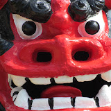
No Tall Tale to Tell Here. But every now and then, I will post a Map It! Photo Moment. I couldn't resist stopping for five minutes to take pictures of these two Shi Shi Dogs or Shisas. And I know some of you would be guilty of the same, so I thought I indulge for you.

Shisas are great for photo moments. You find them everywhere in Okinawa. Some craftsmen add their own unique style. What's impressive about these two Shisas is that they are just as tall as standard soda machine you find anywhere in Okinawa (see photo album).  Plus, their bright red color is magnetic. You can't help to stop and take a photo.

I found them as I was searching around in the town of Kyoda, a small inconspicuous town in Nago right next to the Route 71 and Route 58 intersection. They were standing in front of warehouse or craftsmen shop, perhaps placed there for good luck. Kyoda might be small town, but it does have some interesting sites to see, often not visible even to the wandering eye...to include a Legendary Fountain called the "Water from Hands". You can scroll on the map above and see two sites of interest, in which I will blog about very shortly.

Other places nearby of interest. Kyoda's 'Ato no Utaki', Water From Hands Fountain, Todoroki Watefall, The Nangusuku Castle Ruins, Nago Museum.